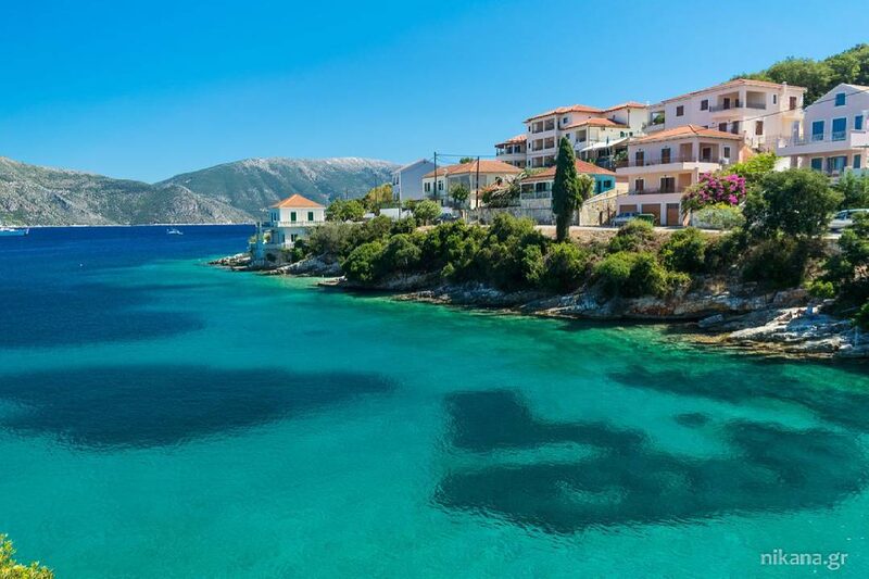
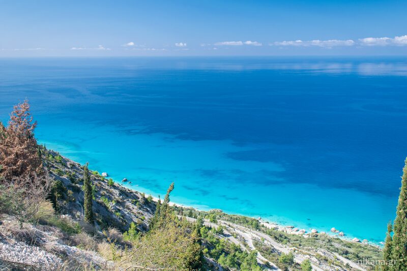
In Halkidiki, there are numerous officially marked hiking trails spread across Kassandra, Sithonia, and Athos. These trails have been developed in collaboration with the Greek National Tourism Organization and local authorities. They are intended for nature lovers, families, recreational enthusiasts, and hikers of all ages and fitness levels.
Below, you can find all the trails we have listed in Halkidiki with basic information on the length of the trails and difficulty.
Hiking Trails in Kassandra
You can view maps of all routes in Kassandra on the Municipality of Kassandra’s website here: Kassandra hiking-trekking.
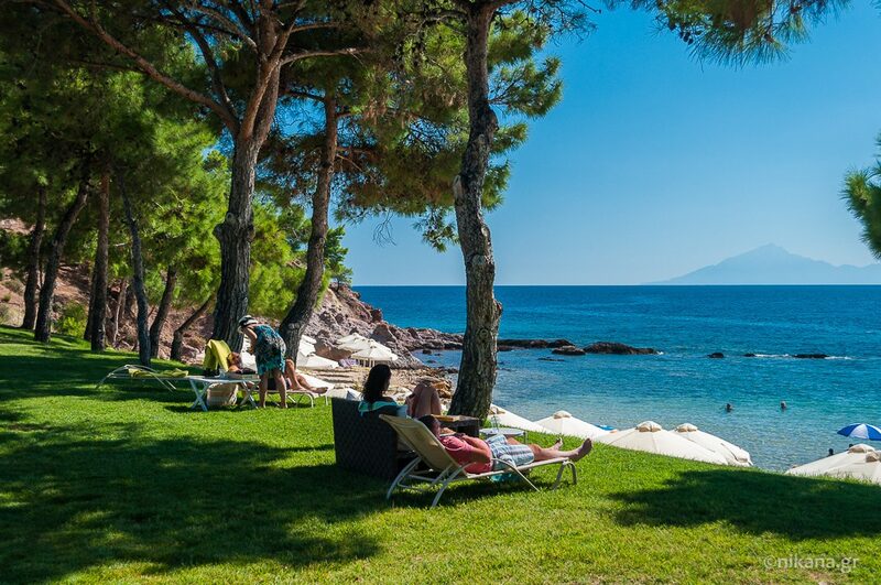
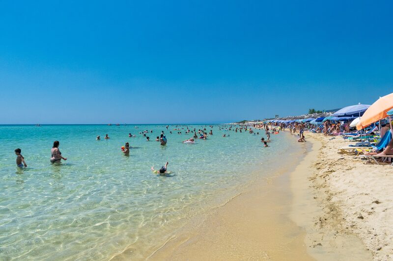
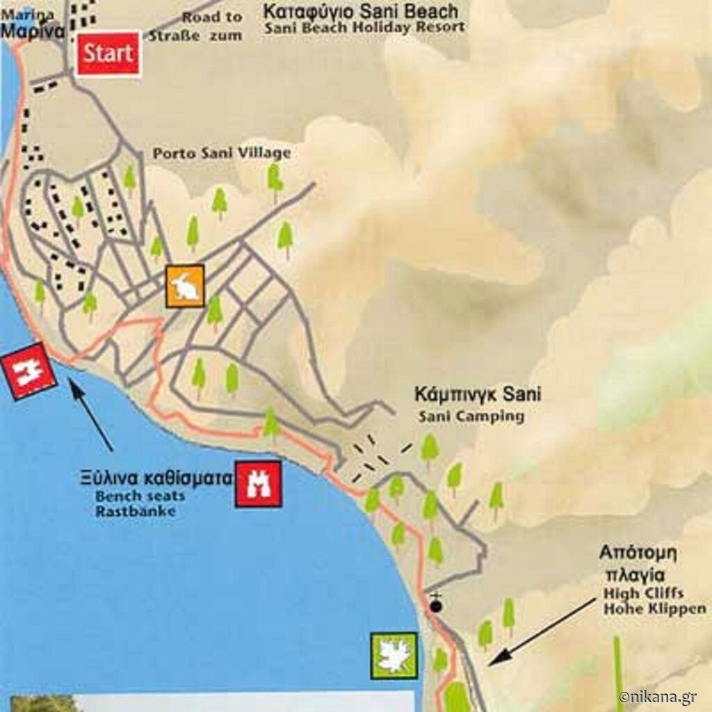
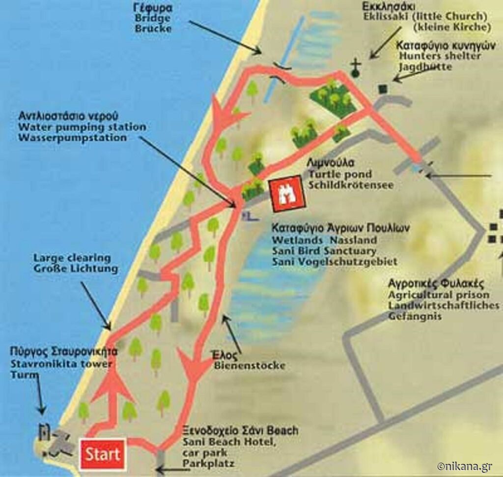
Sani - Bird Sanctuary - Sani
Route Description: A circular trail starting and ending at the Stavronikita Tower in the Sani area. It passes through the forest and marsh, near the bird sanctuary, and returns to Sani. Length of Route: Approximately 6 km Difficulty Level: Easy (with an elevation difference of about 22m) Duration: Around 2.5 hours
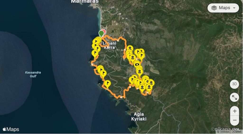
Sani - Siviri
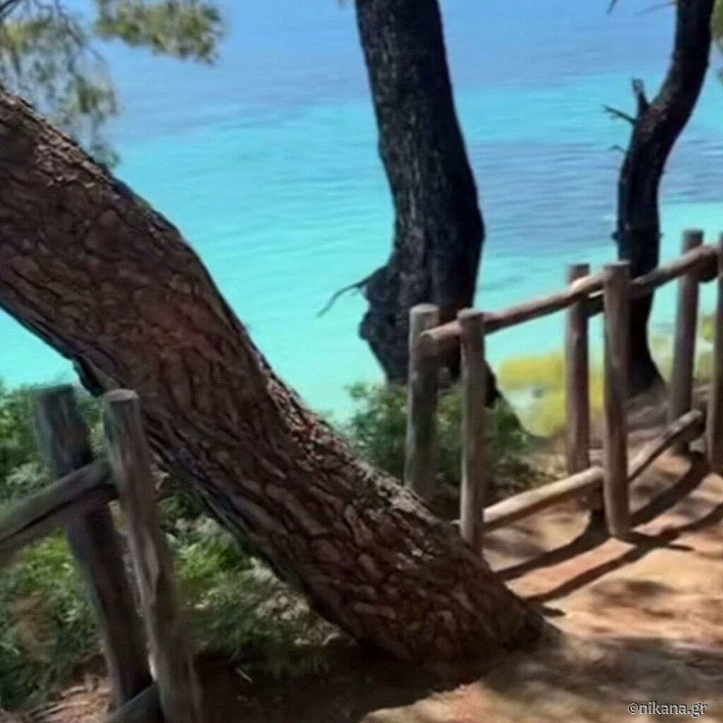
This is one of the most beautiful trails in Kassandra and Halkidiki. We have described it separately in detail. You can see here a short video. Route Description: A one-way route starting in Sani and ending in Siviri. It passes through a pine forest and offers spectacular views of the coast. Length of Route: Around 20 km Difficulty Level: Moderate (with an elevation difference up to 60 m) Duration: Approximately 5 to 5.5 hours (without breaks) Note: Organized return is recommended.
Possidi - Pinewoods - Possidi
Route Description: A circular trail starting and ending at the beach in Possidi. It passes through a pine forest and olive groves, offering a beautiful view of the sea. Length of Route: Approximately 6 km Difficulty Level: Easy Duration: Around 2 hours
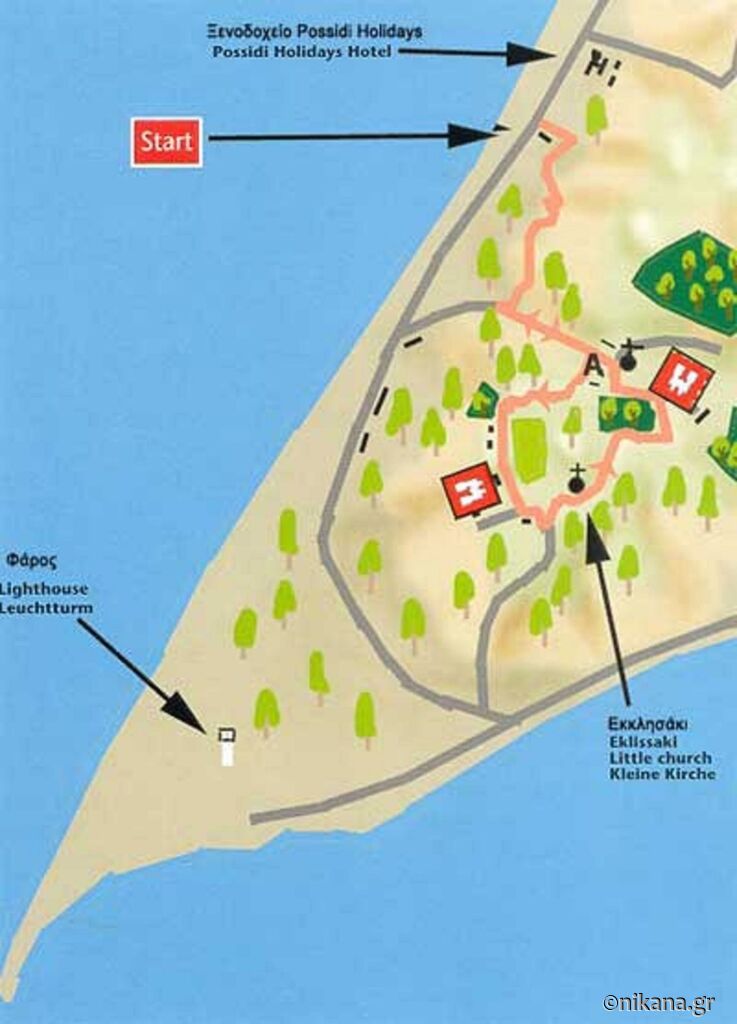
Kalandra - Possidi - Faros
Route Description: A one-way route starting in Kalandra, passing through Possidi, and ending near the lighthouse close to Posidi (Faros). It offers a beautiful view of the sea. Length of Route: Around 4.8 km Difficulty Level: Easy Duration: Approximately 2 hours
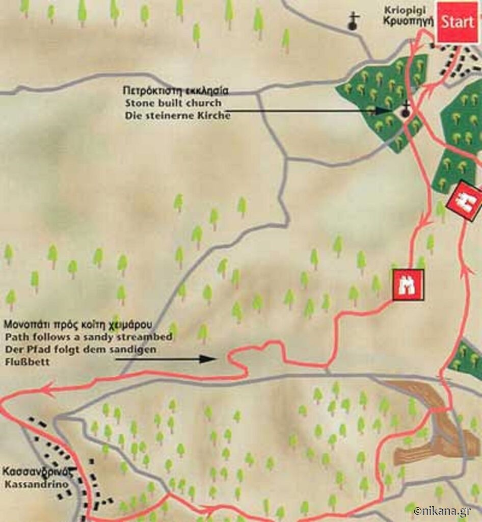
Kriopigi - Kassandrino - Kriopigi
This is a fairly long walk that takes you through the picturesque village of Kassandrino. The village is hidden in the hills of Kassandra and is definitely worth a visit. Route Description: A long path through the picturesque village of Kassandrino, hidden in the hills of Kassandra. Length of Route: Approximately 9 km Difficulty Level: Moderate to challenging Duration: Around 4 hours
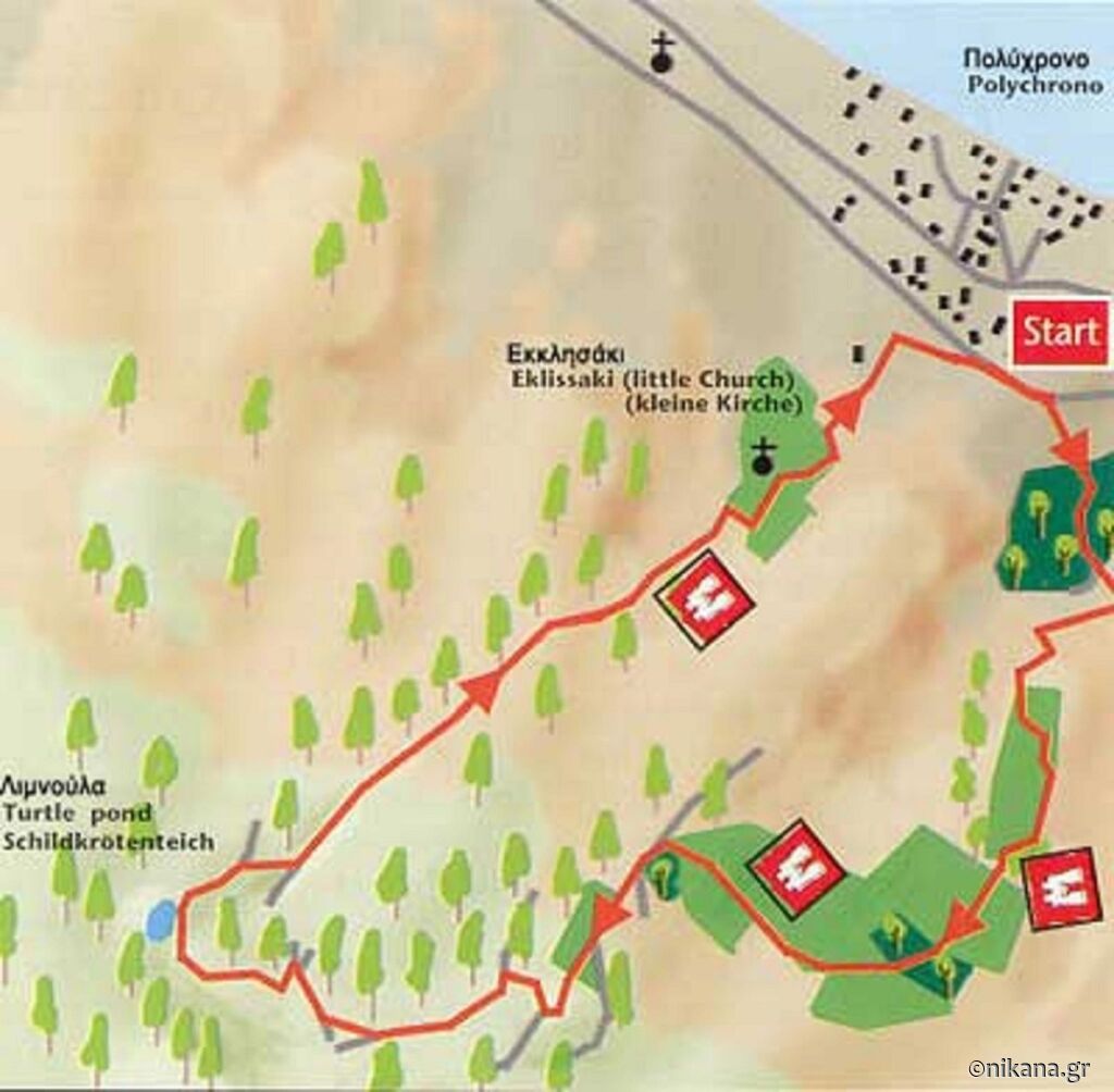
Polychrono - Mavrobara (Turtle Lake) - Polychrono
The trail starts from Polychrono, leads to the Turtle Lake, called Mavrobara, and returns to Polychrono. The route passes through forest paths, a high valley surrounded by cliffs, and a pine forest. Route Description: A circular trail starting and ending in Polychrono. It leads to the Mavrobara Lake, home to rare turtle species, through forest paths and a valley surrounded by cliffs and a pine forest. Length of Route: Approximately 6.6 km Difficulty Level: Easy Duration: Around 2 hours
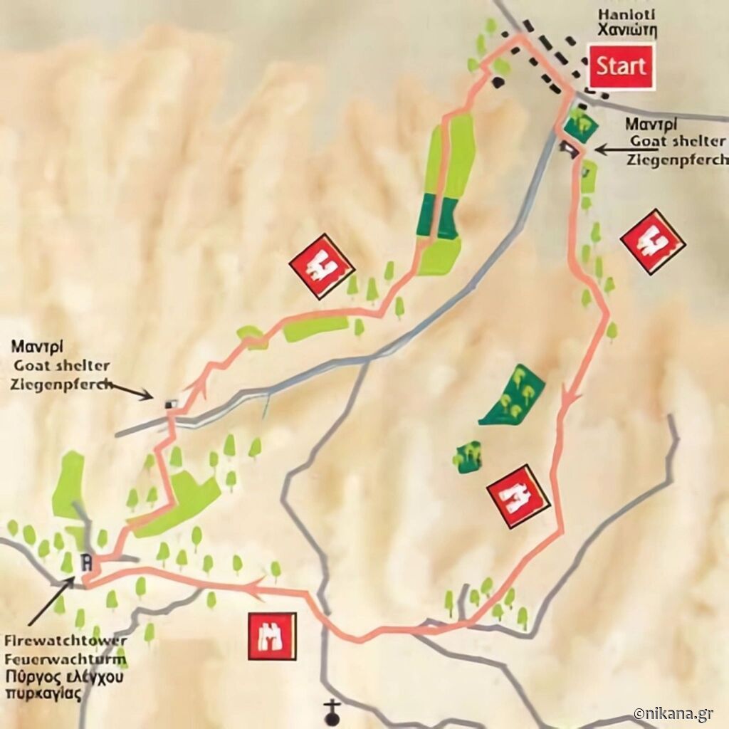
Hanioti - Firewatch Tower - Hanioti
This route starts from Hanioti, follows the ridge to the firewatch tower, and returns back to Hanioti. It is mostly an ascent, reaching an altitude of 300 meters, and the view from the top is stunning. Along the way, you can also see the village of Nea Skioni from a bird’s eye perspective. Route Description: A route starting in Hanioti, following the ridge to the firewatch tower, and returning back. It offers a stunning view of the surrounding villages and the sea. Length of Route: Around 11.5 km Difficulty Level: Moderate (with an elevation difference up to 300 m) Duration: Around 2.5 - 3 hours
Hanioti - Nea Skioni
Route Description: From Hanioti to Nea Skioni on foot. Follow the paths leading to the firewatch tower, then continue towards the other side of Kassandra, to Nea Skioni. The ascent is about 300m, and you will be walking along the main ridge of Kassandra all the time. Length of Route: 9 km Difficulty Level: Moderate (with an elevation difference up to 300 m)
Hiking Trails in Sithonia
If you want to hike and discover the landscapes of Sithonia, check out the recommended trails. You can view the official site for hiking trails in Sithonia here: Hiking Sitonia.
Nikiti - Agios Nikolaos - Nikiti
Description: A circular trail, with forest paths, starting in Nikiti, passing through the village of Agios Nikolaos, and returning to Nikiti. You can also stay in Agios Nikolaos if you wish. Along the way, you will come across the picturesque chapel of Prophet Elias. Length of Route: Approximately 10 km (about 2.5 hours of walking) Difficulty: Moderate, with an elevation difference of around 215m
Elia Beach - Agios Pavlos - Elia Beach
The route starts from Elia Beach, continues uphill to Mount Agios Pavlos, and ends back on the coast of Elia. At about 300 meters above sea level, you will come across a large rock surrounded by trees, offering a charming view from there. Description: Circular tour: ascent from Elia Beach over the chapel of St. Paul and the rock of Petros, returning the same way. Length of Route: About 7 km Difficulty: Easy to moderate, with an elevation difference of about 298m Duration: Around 4 hours
Neos Marmaras - Parthenonas - Neos Marmaras
A route that leads from the town to the traditional village of Parthenonas. This is a long route that passes through the old traditional village of Parthenonas. There are two options depending on your preferences. You can choose the easier option through the Drosia taverna or the more difficult one, where you will see a mill and a dam. Whichever you choose, you will enjoy nature and the beautiful view. In both cases, it is a long route that takes about 4 hours. Description: A circular trail from Neos Marmaras through olive groves and mountains to the traditional village of Parthenonas. Length of Route: Approximately 8–10 km Difficulty Level: Moderate, with an elevation difference of about 340 m; duration around 4 hours
Porto Carras Resort
Within the complex, there are two hiking routes that we will list. However, for a walk in this private complex, it is best to contact the resort. From both walks, it is necessary to return before sunset, in the early afternoon to leave the property. Porto Carras - Vineyards - Porto Carras A circular trail passing through the vineyards of Porto Carras. The landscape and dense vegetation make this route very interesting. Within this route, there are wineries that you can visit, taste, and even buy wines. Porto Carras - Coastal Walk - Porto Carras This route follows the coast and includes about 20 small coves and beaches where you can refresh yourself. The beaches are not commercialized. Sometimes tourists are brought by boats to these beaches for swimming. Detailed description (in English).
Toroni – Lekythos Fortress – Hidden Beach
Description: This trail leads past the remains of Lekythos Fortress, located at the southern end of Toroni Beach, to a small, isolated beach that rarely has visitors. From the highest point of the trail, there is a beautiful panoramic view of Toroni and the wide bay. Head south along Toroni Beach to the remains of Lekythos Fortress, located about 500 m from the hotel. At the bottom of the peninsula, where the fortress is, turn left (southward) on a dirt road. After a few hundred meters, the trail forks – go right towards the coast and enjoy the beautiful view. Look along the coast to the south to spot the target beach. Return to the junction and take the other path southward. The trail may sometimes be overgrown, but it follows the coast. Be careful of thorns on the bushes. The viewpoint offers an excellent view of Toroni, and it is about 500 m to the beach. You will reach a small isolated beach – an ideal place for relaxation and peaceful enjoyment of nature. Hiking Time: 1 hour (total 3 km). Elevation: 70 m Difficulty Level: Easy
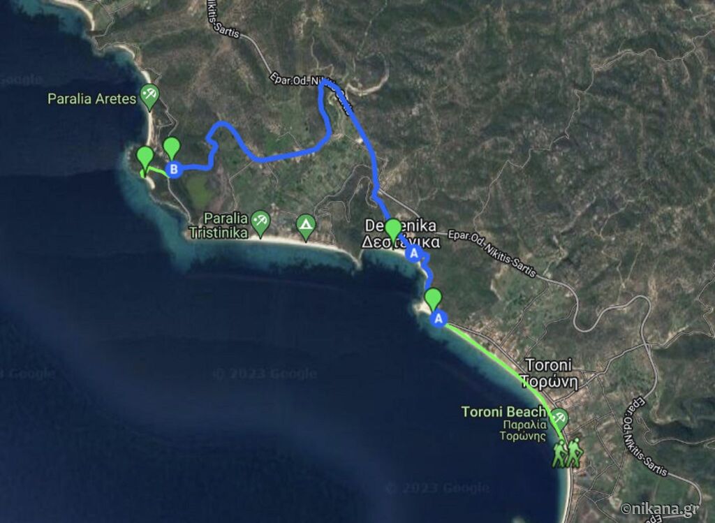
Toroni - Destenika Beach - Paradise Beach - or Aretes Beach
Route Description: Starting in Toroni, this route follows the entire Toroni Beach from south to north and can end at a nudist beach locally called Paradise beach, or continue to Aretes beach. Route: Head north towards Neos Marmaras to a point on the beach. There is just over 1.5 km to the end of the beach. Enter the coastal road and follow it to the next beach – Destenika. There is a small restaurant on the beach. The distance from the point is just over half a kilometer. Destenika Beach is about 2.2 km away: Continue north until you reach the main road around Sithonia. The first left leads to Tristinika Beach - a beautiful beach with few people and a bar. For Paradise beach, take the second left (after Tristinika) towards Aretes Beach. You start an ascent on a dirt road. Paradise Beach is about 5.5 km away (not officially nudist but expect nudists as it is well hidden). When you reach the highest point of the road, turn left onto an unmarked path. Follow it until you reach a fence. Head towards the fence and you will see stairs leading down to Paradise beach. From Destenika to Paradise beach is just over 3 km. If you wish, continue north for another 400 - 500m and you will reach Aretes beach. Hiking Time: 4 hours (total 11 km) Elevation: 170 m Difficulty Level - easy to moderately difficult due to the length of the route.
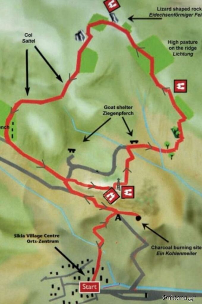
Sikia Village - Ridge above the village - Sikia Village
Another circular route that starts and ends in the village of Sikia. Caution is needed at some points due to cases of dog attacks on hikers. Route Description: The route starts at the entrance to the village of Sikia, crosses a bridge and leads northeast on a dirt road. The trail passes through a rocky path along the valley, then over a wider dirt road under a telecom antenna, climbs to a peak with a view of the valley and goat towers. Note: do not approach the goat towers due to guard dogs. The path continues over a dry streambed, olive groves, and large rocky formations, reaching a field at around 280 m above sea level with a panoramic view, then continues northwest along the ridge past a distinctive lizard-shaped rock, descends into the valley, and ends through goat paths in the village of Sikia. Duration: Around 4 hours Elevation Gain: ~345 m Difficulty Level: Moderately difficult but uncertain due to guard dogs of the herd. Good footwear is essential at steep sections. Detailed Description (in English).
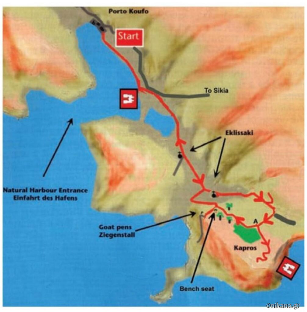
Porto Koufo - Cape Kapros - Porto Koufo
Route Description: The route leads to Cape Kapros, the southernmost point of the peninsula, offering a unique view. The path passes by Maratias Beach, and before reaching the cape, there is another small beach. From Cape Kapros, on a clear day, you can see the Sporades islands. Starting Point: Porto Koufo natural harbor (near Porto Koufos hotel, along the main road). Route Type: Circular (out and back). Length: Around 11 km round trip. Duration: 3-4 hours of walking. Elevation Gain: Around +250 m ascent. Difficulty: Easy to moderate (due to ascent and narrow paths). Surface: Dirt tracks, goat paths, narrow rocky passages. Equipment: Comfortable hiking shoes, water, GPS or map (due to poorly marked trails). Detailed Description (in English).
Toroni – Porto Koufo – Maratias Beach – Southern Tip of Sithonia
Route Description: A hiking tour from Toroni to the southern tip of Sithonia, visiting Porto Koufo and the hidden beaches of Maratias and Lemos. The route starts in Toroni (you can also start from Porto Koufo) and leads to the southernmost point of Sithonia. Along the way, you will see Porto Koufo, the deepest natural harbor in Greece, resembling a fjord. The trail includes access to beaches that are more difficult to reach and rarely visited - first Maratias, then Lemos. Ideal for nature lovers, tranquility, and hidden beaches. Note: at the actual cape is the unorganized Lemos beach, we advise caution if swimming as the sea currents are always stronger at the cape points due to the crisscrossing. Length of Route: 19 km (circular trail) Duration: About 6 hours of hiking Difficulty Level: Moderate – the trail is not technically challenging, but the length makes it a long day if you want to enjoy the beaches.
Hiking trails on Mount Athos
Viewpoint to Mount Athos
You can hike from the port of Tripiti to the ridge across the bay of Mount Athos and admire the beautiful landscape. The blue sea and clear sky will leave an unforgettable impression.
Ouranoupoli - The border of Mount Athos
This route from Komitsa beach to Ouranoupoli is the road that separates Mount Athos from the rest of Greece. It is quite easy. You can walk along the border along a forest path and enjoy the magnificent view of Halkidiki and the Aegean Sea.
Byzantine Tower in Ouranoupoli - The border of Mount Athos
This tour is also called the archaeological route. It starts from the Byzantine tower of Prosforios in Ouranoupoli and ends at the border of Mount Athos, near the Zigos monastery. Trail length: 3 km Difficulty: easy
Ammouliani
Ammouliani is the only inhabited island of Halkidiki, and the tour of the island is a fairly easy route with panoramic views. It is worth following and enjoying the beauty of the island.
We are always here to help you explore Greece! Follow us for the latest information, useful tips, and authentic experiences to make your holiday in Greece unforgettable!
We offer over 3,000 accommodations. Choose the one that suits you and your family by clicking HERE.
+
Internet as soon as you cross the border
You can have Internet as soon as you cross the border by purchasing our Nikana eSIM card here: https://nikana-esim.com/ Setting up is very simple, via a barcode in a few seconds you will have internet on your phone for any country in the world. Detailed instructions, how to check if your phone supports eSIM and answers to all questions can be found here: Nikana ESIM internet
Follow us on social media where we regularly share exclusive offers, discounts, and special holiday packages for Greece, as well as information, tips, and useful news. Facebook: Nikana.gr Instagram: @nikana.gr Tiktok: nikana.gr Facebook group: Live from Greece YouTube channel @NikanaTravel Email us at: nikana@nikana.gr Visit our website nikana.gr, the leading source of information about Greece in the Balkans.